Showing posts with label archaeology. Show all posts

Wednesday, 5 April 2023

Croatia 2023

 The drowned landscapes off Croatia

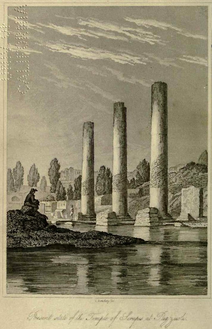
I visited Croatia a number of years ago after diving on some of the submerged Roman sites in Greece and seeing the Temple of Serapis in Naples (https://upload.wikimedia.org/wikipedia/commons/9/9e/Charles_Lyell_-_Pillars_of_Pozzuoli.jpg) . The temple is geologically infamous as the front piece to Charles Lyell’s seminal work The Principals of Geology where he notes the mark of marine boring organisms at some height up the columns thus indicating that they were once submerged.  He correctly interprets this as representing tectonic movements that have caused both a submergence and subsequent re-emergence of the temple since its construction in the late first to early second century AD. Contemplating the potential for drowned landscape reconstructions around the Mediterranean and Adriatic seas I briefly looked for papers describing sea level changes.  These were almost entirely absent from the academic literature.  Fast-forward to 2023 and I am here on the invite of Dr Simon Fitch (Bradford University) as part of his Future Leaders project. The idea is to map paleo-landscape surfaces in the many rias (drowned river valleys) along the Adriatic eastern shore. 

Split, Croatia
The project in Croatia is partnered with Dr Vedran Barbarić at the Faculty of Humanities and Social Sciences, University of Split and the first trial survey was undertaken on board the Pram, expertly skippered by the enthusiastic and knowledgeable captain Jerko Macura . For the acquisition we had chosen to use an Innomar Quattro parametric sonar (https://www.innomar.com/products/multi-transducer/quattro-sbp).  This hull-mounted sonar is configurable as either a line of four transducers emitting separate signals for high-resolution 3D type survey or as a block of four transducers working together for greater power and thus sea floor penetration.  The unit was side-mounted together with a Novatel IMU GNSS unit to provide heave corrections.  

Innomar Quatro with Novatel dual antenna motion reference unit

Over the course of 5 days we surveyed a number of small bays, outlets to the main large bays, channel crossings and both large and small deltas.

The weather cooperated for the most part until the Bora winds (a sever katabatic northerly wind from the shore) stopped play on our last day. The survey exceeded our expectations with penetration to greater than 15m sub-bottom in water depths up to 70m deep.  The seismic reflectors and character demonstrated sequences that could be interpreted as eroded bedrock, basin sediment infill, channel cuts, deltaic progression with periods of both regression and transgression. 

Channel entrance to the old harbour of Split

The potential for mapping multiple palaeo-landscapes and associated environments is huge. We now need a program to accomplish this that has ground truth from coring and careful modelling.  The project has only just begun so here is looking forward to returning and working with a great team.


Thursday, 22 September 2022

Preserving Maritime Cultural Heritage through Music - 2019-2021


Tanzania - This Post was summarised for me by Jamie Locke-Jones @ the Research Impact Office, University of St Andrews

Once described by Moroccan traveller Ibn Batutta as one of the most beautiful cities in the world, the UNESCO World Heritage site of the Ruins of Kilwa Kisiwani and Songo Mnara, south of Dar es Salaam on the coast of Tanzania, date between the 11th and 18th century. Today, the remains of the palace, the grand mosque and merchant trade centre stand in ruins close to a shoreline that is increasing impacted by changing climate. Unlike better-known World Heritage sites, such as the Pyramids of Giza or the Great Wall of China, the Ruins of Kilwa Kisiwani and Songo Mnara have not received the attention they need if they are to survive another eight centuries. 

A collaboration between the University of Dar es Salaam (UDSM) and the School of Earth and Environmental Sciences at the University of St Andrews sought to address this through a thorough assessment of the sites’ fragility. The group conducted marine geophysical surveys which showed several locations of potential wreck sites, with follow-up diving confirming that one was a 13th century wreck. The team’s goal was to investigate the wreck and at the same time build local capacity by training divers from across Tanzania in underwater archaeological techniques. This work has since led to the development of the first National Digital Heritage Databases for Tanzania.

A step change in engagement came with the recording of a music video (above) sung by a popular Tanzanian female rapper Claudia Lubao, known as Chemical, and composed by the team’s academic archaeological partner, Dr Elgidius Ichumbaki, at UDSM.  The song highlights the importance of heritage with a connection to local people, warning about the impact of climate change to the sites and the environment surrounding them. 

Now a PhD student at the University of St Andrews, Claudia’s music has set a precedent in bringing cultural heritage to new audiences. The Kilwa Yetu song brought widespread attention to the plight of the site that other methods of promotion could not have achieved by reaching audiences outside the reach of more traditional, academic avenues. A further video on Africa’s heritage was launched at UNESCO’s headquarters in Paris in May 2018. This video gave the local community a voice to discuss their heritage, which has led to significant policy changes at a national level.

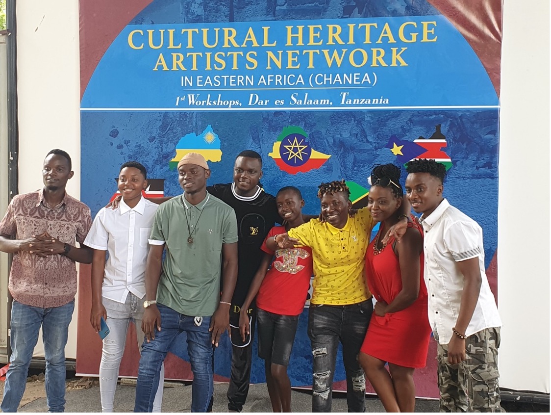
These collaborative initiatives and the music videos behind them have provided a more inclusive mechanism to promote information on the cultural heritage, moving outside the immediate intellectual circle of academic publishing. With a latest video, funded by the British Council’s Cultural Protection Fund, the team was able to expand their interests to include heritage across more of Eastern Africa with contributions from academics and artists from Kenya, Uganda, Ethiopia, Sudan and Rwanda. At workshops held in Dar es Salaam, the Cultural Heritage Artists Network in Eastern Africa (CHANEA) was established with the aims of preserving, protecting, and promoting both tangible and intangible heritage throughout Eastern Africa. Key sites highlighted in the video and from these countries include Zanzibar, Mt Kilimanjaro, Thimlich Ohinga, Kilwa Kisiwani, Mt. Rwanda, and Mt Kenya. Watch the latest music video below:

If you enjoyed CHANEA’s latest video, watch a behind-the-scenes documentary on its production here.

Monday, 1 April 2019

Kilwa Bonanza


Heritage Futures and Community Archaeology in Tanzania

The Kilwa Kisiwani site off the coast of Tanzania was occupied from the 9th and was one of the most powerful settlements along the Swahili Coast.  From the 13th to the 16th century, much of the trade in the Indian Ocean was handled by the merchants of Kilwa, who dealt in gold, silver, pearls, perfumes, Arabian crockery, Persian earthenware and Chinese porcelain. In 2004, the ruins were placed on the List of World Heritage in Danger (https://whc.unesco.org/en/list/144).  The Great Mosque of Kilwa Kisiwani is the oldest standing mosque on this coast and the monuments are still in everyday use today by both villagers and as one of the oldest Muslim schools in East Africa. However, the pressure of daily use as well as the impacts of climate change, manifest by sea-level rise and increased weathering and vegetation growth, are threatening to severely degrade the heritage site.
Kilwa Kisiwani World Heritage Site
The interdisciplinary ‘Safeguarding Heritage in Tanzania’ team from the University of St Andrews, comprising Dr Richard Bates, Donald Herd and Dr Ted Pollard (Earth & Environmental Sciences), Elie Graham (History), and Dr CJ Davies (Computer Science), together with colleagues from the University of Dar es Salaam (Dr Elgidius B. Ichumbaki), have recently returned from a highly successful field trip to Kilwa Kisiwani, Southern Tanzania. 
The team are investigating the Kilwa site using remote sensing technologies and initiated a community-led programme for raising awareness to the potential loss of both tangible and intangible heritage in the area.
preparation of dGPS, and drone surveys, Kilwa
 Despite previous international aid programmes for protection of the tangible heritage, often little is done for the local community. In March 2019, the team hosted an education day, “Kilwa Bonanza”, with local schools, bringing to the island over 150 primary and secondary pupils for tours of the site.  Following the tours, the school groups were joined by over 250 people from the local community to enjoy the benefits of their heritage. Raising public awareness and the popularisation of the sites is being aided by the use of contemporary performing arts (https://youtu.be/xaD93UJqfOg).
In addition to the community groups, the “Kilwa Bonanza” was attended by local District Commissioner, representatives of the Department of Antiquities, Dept of Tourism and local business.  The Bonanza was catered for by a new start-up venture, WAUMAKI (The Woman’s Culture, Buildings and Heritage Organisation in Kilwa). This group aims to provide visitors to the site with tour guiding, transport around the site and local region, catering for the visitors as well as offering a range of indigenous, locally-produced  hand-craft.


Kilwa was a site that is intimately associated with the sea, with people relying on the sea for resources and, historically, for trade. The nearshore coast also contains heritage in the form of submerged structures, due to sea-level rise, and shipwrecks.  As part of their preservation training, the team taught the first Nautical Archaeological Society underwater archaeology courses (Parts I & II) in East Africa to a group of local divers from government agencies, university departments and local tour companies.  The trained divers will provide a valuable resource for maritime archaeological investigation in the future. Some stunning new finds from a possible 13th century wreck near the old Omani port in Kilwa were recovered on the last day of the training.
Pottery destined for curation at the National Museum

Tanzania does not have a country-wide digital database for their cultural heritage. The team met with the Director General of National Museums in Dar es Salaam as the first step to working with them to produce this. A digital record is seen as a vital resource for recording sites (such as those at Olduvai Gorge where the Leakeys accomplished their ground-breaking work on early hominins), managing sites, protecting them and creating a long-term legacy for the country. It is hoped that the approach adopted by the project in Kilwa, especially the inclusion of community outreach, will provide a blue-print for other sites across Tanzania and Africa.
Following the signing of a joint MOU between St Andrews and the University of Dar es Salaam, Tanzanian staff will be visiting the University of St Andrews in May to train on field and processing digital techniques and to work on some joint Scottish-Tanzanian fusion of musical experiences in the promotion of our joint heritage. For more on the project, see www.urithiwetu.org .


Wednesday, 11 July 2018

Callanish Geophysics


Callanish (Re-visited)

At the end of last year we were invited to do some further recognisance work in the Outer Hebrides at the iconic Callanish (Calanais) standing stone sites.  We had visited these back in 2016 as part of surveys for the Ness Historical Society in northern Lewis and were not only impressed by the stones and their setting but a little surprised about the lack of any other significant historical sites in the surrounding landscape.  On return from this trip I started to read more about the area and it turns out that relatively few excavations have taken place here over the last 50yrs or so.  For those who have not visited the sites then I can only urge you to do so. 
So what was our job here?
We have two primary objectives for studies at Callanish.
  • First we need to map the old landscape to enable us to understand where and how people might have used it.
  • Second we need to investigate potential occupation sites, in other words, find the people in the landscape!

The stones are very different to those in the Orkney Isles that we have been working on for the last few years.  The primary rock at Callanish is the beautiful, banded metamorphic Lewisian Gneiss.  At a little over 2.7 billion yrs old these are some of the oldest rocks in the UK – their age is a testament to their surviving power.  Deformed under numerous tectonic events they are hard and resistant to erosion.  Their beauty, with swirling patterns of dark amphibole minerals coalescing into augens (literally eyes), gives an additional sense of mystery to the standing stones.  The rock’s resistance to erosion is another feature of the landscape that the Neolithic people would have had to deal with.  Unlike in the Orkney, where stone is readily prised from the bedrock, Lewisian Gneiss does not break off with the same ease.  Rather, substantial effort is required.  This, along with the soft curves of the standing stones suggests that this material was not quarried in substantial quantities from the bedrock, rather at best it was prised from the surface or picked up from where it had fallen.  (for more on the creation of the Lewis landscape as a function of successive glaciations see Dawson et al. 2016).

Palaeo-environmetal work in Lewis and Harris have shown that prior to the re-peopling of the islands there was open woodland cover but with increasing human activity around 3900yrs before present there was an expansion of heather moor and the spread of grassland.  The latter possibly occurred as a result of fire and grazing. (Birks and Madsen).  The changes in vegetation and the deterioration of weather further encouraged the growth of the peat that is such a dominant part of the landscape today. In fact the peat growth is so prolific that when the main standing stone site was first investigated in the 19th C over a meter of peat removal was necessary to expose the old landscape. Electromagnetic surveying around site III indicates that this technique could well be used to map peat thickness.


This result of the removal is manifest by the weathering marks seen on old photographs of the site.  The prolific peat growth is likely one of the reasons that we do not know a lot more about this old landscape as it remains deeply buried today.  There is another part of the landscape however and that is the one that has been lost to sealevel change.  As with many places around the Scottish coastline the sealevels have risen significantly since last glacial maximum.  The story in the Orkney Isles is fairly simple with a steady rise to about 4000 years ago when it reached  near enough present levels.  In the Outer Hebrides it is a little more complex with a sharp rise followed by slightly higher sealevel than today and then a fall and rise again.  Such a complex signature is a result of the interplay between global sealevel and local tectonics (that is the compensation for the pushing down affect of the ice on mainland Scotland).


The field work was undertaken over three trips earlier in the year.  Initially I visited with Mel Chocholek and James Killingbeck in order to survey some of the lochs surrounding the main site.  At this time we also undertook more photography for structure from motion 3D models of the upstanding stones sites and tested electromagnetic ground conductivity geophysics across some peat areas near the main stone circle.  In January I returned to the site with Vince Gaffney and Chris Gaffney from Bradford, James and Shiobhan Killingbeck, Tim Raub from St Andrews and Fanny Bessard from Bristol.  During this trip we concentrated on one site, Callanish XI in order to test a range of geophysical methods for intense survey.   I will report on this site later.  On Callanish X we scanned all the stones and this will shortly be rendered as a full 3D reconstruction of the site. 

In late January I then returned with my brother and Mel with the Swordsman to conduct further offshore surveys and to acquire core data through some of the sediment units.


This shows some of the sub-bottom profile data that indicates the area will have sediment that we can target for environmental information. 

Thursday, 1 March 2018

Irish Sea Cruise

So if you follow what we have been doing on the Lost Landscapes front over the last couple of years you will know that we have a large programme of work on reconstructing “lost”, submerged and buried landscapes around the world’s continetnatl margins.  The Lost Landscapes project is one of the core elements of this programme and is an EU-funded project based around reconstructions in the North Sea across what has been termed Dogger Land. A recent addition to this project has been an extension into the Irish Sea and specifically in Liverpool Bay and Cardigan Bay off the Welsh coast.  Liverpool Bay was the focus of work a few years ago before the large windfarms were constructed and has been written up in a series of reports and books (see Fitch and Gaffney, 2011 for example). I will leave this for a later discussion.


Cardigan Bay has of course always been of interest to me growing up in Aberystwyth - swimming at Clarach, walking the coastline to Aberaeron and New Quay and playing in the dunes of Ynys Las.  More recently I have also been doing some work with my brother and father on the submerged forests at Borth.  Throughout my childhood I remember walks to see the forest of stumps that are periodically exposed after storms rip in from the Atlantic on this stretch of Welsh coast.  Over the last few years they have been exceptionally well exposed as there have been various engineering works going on along the shore for protection measures.  Back in February 2012 while my parents were taking one of their usual “what’s going on?” walks my father noticed blackened and shattered stones amongst the stumps which my brother later identified as burnt cooking stones.  This led to a series of projects investigating the site that yielded not only some well-preserved animal foot prints but the most impressive set of ancient red deer antlers (dated to 2940+/-30 B.P.)  that I have ever seen!  We did some geophysics (resistivity imaging and electromagnetics) on the beach which was published in 2016 (Bates and Bates, 2016). The forest here is dated to Bronze age but the deposits extend under the beach and offshore.  It is these earlier deposits that we were attempting to target with the current survey.  Specifically we hoped to be able to map the Mesolithic landscape and acquire material from that time period for environmental analysis including DNA sequencing. 
Borth fossil forest - photo D. Bates

To survey kilometres offshore and get core material through potentially metres of modern marine muds requires large survey vessels.  Thankfully a collaboration with colleagues at UCC (Dr Ben Geary) and IT Sligo (Dr James Bonsall) gave us access to a week on the Celtic Explorer.  This vessel is operated by the Marine Institute, Ireland and is equipped with all the tools of the trade including multibeam sonar, sub-bottom sonar, sidescan sonar, and both vibro-corer and gravity corer!  Lots of TOYS!!!  (For a link to these jump to the end of this blog)

After some initial set-backs with logistics the Voyager crossed the Irish Sea up to Liverpool Bay.  A night of geophysics yielded a number of target spots for the coring.  Here the previous work greatly aided us in picking target sites but the overlying sand proved too much of a challenge for the 3m vibrocorer.  So on to Cardigan Bay.

Background work for Cardigan Bay is a lot more sketchy than up north with most of the previous surveys collected back in the late 70s for speculative oil and gas exploration.  Our first task was once again to gather information from the geophysics.  The subbottom profiler on the Voyager is a two by two pot pinger.  Usually I would be a little sceptical of these for giving any great penetration of the seafloor however this setup has completely made me re-evaluate that.  From the first we started to see small channels buried a few metres beneath the present day seafloor that cross cut what appeared to be a glacial till horizon. Till is the material that is left as a result of ice retreat and so tells us about conditions during these cold periods of history.  The last cold (glaciation) period had its maximum about 27,000yrs ago (Clark et al., 2009) with ice reaching far down the Irish Sea and covering the Welsh landscape.  Draining the ice sheets would have been rivers that flowed across a barren plain in front of the sheets.  Because of the ice global sea level was much lower than today by up to 120m and so this part of Cardigan Bay would have been land following glacial retreat.  Where the rivers coalesced large channels formed which cut deep into the till as the climate became warmer.  By the Mesolithic, it was these landscapes criss-crossed by the rivers that people would have migrated back into before they became covered by the rising sea. 

Some modelling work that I had done a few years ago was used to test where the rivers had once flowed and it proved remarkably insightful.  The extent of the deep erosion of rivers however was something that totally blew us away!  Channels 20-30m deep contain multiple fill events suggesting a complex drainage history to the Welsh landscape.  There is clearly a stunning story to be pulled out of this area that will need a lot more geophysics to understand.  We will also need a lot more coring as our attempts at this proved not as successful as the geophysics due to drift of the boat in the currents and wind.  The cores that were taken will now go back with my brother to his lab for analysis and we hope to return to the site next summer for more geophysics and coring.  Ultimately these core will be examined for a whole range of environmental signatures including some DNA analysis that could potentially reveal what the landscape was like and what or who might have inhabited it!
Channel offshore Aberaeron


The Celtic Voyager and willing crew made the cruise a real pleasure, though I am going to have to go on a serious diet – how the crew do this month after month is beyond me or would be beyond my will power when it came to meal times!

This project is part of the Lost Frontiers EU research grant led by Prof Vince Gaffney at Bradford University.

Multibeam sonar -  Konsberg EM2040 
Pinger - SES500 Geopulse
Sidescan sonar - Edgetech 4200


Bates, C. R. and Bates, M. R. 2016. Palaeogeographic Reconstruction in the Transition Zone: The Role of Geophysical Forward Modelling in Ground Investigation Surveys. Archaeological Prospection, v. 23, pp. 311-323
Clark, et al., 2009. The Last Glacial Maximum. Science, v325. 710-4. 10.1126/science.1172873
Fitch, S and Gaffney, S. 2011. West Coast Palaeolandscape Survey


Wednesday, 1 November 2017

Swifter than Eagles: a photographic documentation of Lt Col. Sprot's wartime journeys

So now for something different...............The Curious Travellers project relies on donations of images from members of the public who have travelled to interesting places, and immortalised them in their photographs. In mid-May I visited Lt. Col. Sprot, retired commander of the Royal Scots Greys, to look through his photographic record acquired both during and after WWII in campaigns throughout N. Africa, the Middle East and southern Europe. The Royal Scots Greys was one of the oldest cavalry regiments of the British Army until they merged with the 3rd Carabiniers in 1971.
Lt. Col Sprot
During WWII, they were first sent to the Middle East, which is where our story begins. In 1939, Adian Sprot enlisted and after the usual training period joined the regiment on the long boat journey round the Cape of Good Hope to arrive in Palestine in time to take part in the transition from horse to mechanised vehicles. As one of the few who could drive, his initial duties included the instruction on the new wheeled vehicles. The introduction of Grant and Stuart tanks followed rapidly in 1941. Fighting the German Panzer divisions along the North African coast from the second Battle of El Alamein to the subsequent chase of Rommel east to Syria took Lt. Con. Sprot through locations and sites that are the current focus of the Curious Travellers project.
Lt. Col. Sprot in the Sinai

Following the North Africa campaign, the regiment was refitted with Sherman tanks in time to participate in the Salerno landings (Operation Avalanche) and to advance on Naples. Their stay in Italy was short-lived, however, as the call came to return to Britain in preparation for D-Day. As part of the second wave on 7th June, the first three tanks of the regiment landed on Juno Beach. By September, they were part of Operation Market-Garden with fighting around Eindhoven that continued in the Low Countries through the winter. Their final big push came with a dash to the north, arriving in Wismar on the Baltic coast on May 1st just hours before meeting up with the Red Army. The regiment remained in Germany post war but returned to the Middle East during the Aden Emergency in 1962.
One of Lt. Col. Sprot's pictures of the ruins at Palmyra
Lt. Col. Sprot had retired by this point but with a keen interest in history he continued his travels through many of the countries in which he had previously campaigned. Today, he lives quietly in the Scottish Borders and at 98 years old still has not only a keen interest but a very clear memory for events that are now over 50 years in the past. His best memories are centred on the sights such as the countryside of Palestine in early spring bloom, the monuments to cultures now long gone and the places with links to Biblical history. His less pleasant memories include having to “make-do” with Canadian Club rather than a good Scottish Malt – “not that we were going to turn our nose up at anything!”
Lt. Con. Sprot’s photographic collection taken whilst on campaign and immediately following his retirement include pictures of Palymera and Cyrene. The Curious Travellers project is making rapid progress on the digital 3D reconstruction of these monuments and the photographs provided by Lt. Con. Sprot will add vital detail to them. The response to the Curious Travellers project has been tremendous with the number of images received in the thousands. However, to fill gaps in the models and get a more complete picture of the monuments, still more are needed. An interesting aspect that has surfaced from the project so far is a validation that we are largely people of similar habits. From the photos gathered, it is clear that most people take pictures from the same places pointing cameras at the same scenes. Rarely do we look around the corner or take a picture from the other side – perhaps this work will encourage us to do so and find out more about the places we visit.

Finally, you can find out more about the project at Curious Travellers: http://www.visualisingheritage.org/CT.php.
To learn more about the life of Lt. Con. Sprot from his memoir of the war, read Swifter than Eagles: War Memoirs of a Young Officer 1939-1945, Pentland Press, Durham, 1998.


Tuesday, 31 October 2017

Armenia

The Ararat valley in Armenia sits between the Gegham mountains to the east and the impressive volcanic edifices of Mt Ararat in Turkey to the west.  The valley has been an important pathway for both population migration and for trade routes over the last three millennia.  During the middle Ages, and particular between about 500AD and 1500AD the valley saw the rise and fall of the great medieval cities such of Dvin and Artashat.

In early October Tim Raub and I were invited to join Dr Fanny Bessard and Dr Paul Churchill as part of a pilot study of the valley to ascertain if there were suitable records to investigate the role of climate, environmental change and natural hazards in the history of the country. 

The Ararat valley today is an extensively cultivated valley that in the autumn provides a bounty of both fruit and vegetables.  These come at a price however, and that price is the supply of water.  The Aras river, while a significant feature of the valley, can by no means supply all the necessary water for cultivation.  This has to come through channels and pipes from the nearby mountains and from groundwater.  The other piped resource that is in use everywhere is the supply of natural gas.  Unlike many countries, the pipes for this are all above ground, a safety feature built into the urban and rural structures as a defence mechanism for living in an earthquake zone.

https://sketchfab.com/models/1cc062741aa840b0b7ae34e6148853f9
Our first tasks at the now ruined city of Dvin was to determine the environment and possible original reasons as to why the town was founded at this particular location.  There is evidence of site occupation stretching back to at least early bronze age as the site stands proud of the surrounding landscape.  Close inspection revealed a bedrock base that is likely a gravel terrace remnant of the old piedmont surface extending from the mountains to the east.  This has been dissected in parts by a series of river channels which today have either dried up or been modified to harness the water for irrigation purposes. While Tim mapped the geology, I undertook frequency domain electromagnetic surveys in the hunt for the channels and their relationship to the outside walls of the old city. The results were combined with digital terrain and photographic models that show great promise for our future work.

Armed with the knowledge that water supply from the uplands likely played an important controlling factor in both rural and urban centres we moved our investigation up to the hills. Immediately to the east the geology consists of mainly sedimentary rocks and in particular Permo-Triassic limestone  (more on this later). To the north east however, the geology quickly gives way to igneous complexes associated with the numerous volcanic centres in the region.   
Permo-Triassic Boundary
While the climate, and thus rainfall patterns are similar, these different geologies manifest themselves in very different hydrology and scenery. On the sedimentary rocks, fast flowing but ephemeral streams erode steep valley sides whereas the igneous terrain tends to a rolling landscape with more sustained overland flow of streams and rivers.  This means no way of capturing the water in the south in reservoirs, rather the natural springs have to be tapped at source.  However, in the north the hunt is on for where water storage schemes might have been built.  Means for the transport of water is in evidence everywhere.  Leets run parallel to many hillsides and mark the stark contrast from barren land above the leets to lush agricultural land below.  Evidence of buried water conduits in the form of clay pipes of all manner of size and shape have been unearthed from highland villages to the towns across the valley floors. Tracing these will be a priority for future work and trying to understand the pattern of distribution and timing of their construction and demise could be crucial to an understanding of the history. For example, what happened to them when earthquakes struck?

Temple of Garni
So back to that geology.  Tim had done his home work and knew about a few sites that he thought worthy of visit.  The first was where the Azat river cut down through the basalts beneath the Temple of Garni.  The temple dates back to the first century AD and has survived transformation and use through many different religions.  The columnar basalt is quite something else which blew us away totally.  This has to be one of the most spectacular basaltic exposures in the world!


The second site was in the sedimentary sequences to the south and when approached from the southern road out of Lake Sevan you are confronted by a sudden drop-off into the steep limestone valleys that reveal a 1200m section of limestone and calcareous shales with hues from pink to cream that represent one of the best exposures of the Permian to Triassic mass extinction event anywhere. The extent of the exposure is quite remarkable both laterally and in the vertical transition.  Great student mapping projects to be had here!   

The third site he wanted to visit was to the east at Lake Sevan.  This large upland lake sits along the Spitak fault that marks the juxtaposition of ophiolite complexes to the east with the basalt and sedimentary sequences that lead down to the Ararat Valley.  The fault, as with many other ones in Armenia, is still highly active, a feature of the region that is felt on a regular basis with significant earthquakes.  The last major of these had an epicentre further north along this fault zone that struck with a magnitude 6.8 event in 1989 killing over 30,000 people. Understanding more about the timing of earthquakes could help our archaeological studies and thus we needed to find sites with long environmental records that were punctuated by features that showed the earthquake record.  The delta on the northern river inlets gives just that kind of section with what appears to be a series of down-faulted land surfaces in a cyclic and fairly uniform sequence.  This should provide just the kind of record we need for future detailed study.
Tim at the Sevan section of repeat cycles

Armenia has so much to offer in way of study sites both geologically and archaeologically.  The people were great (especially thanks here to Drs Babajanyan and Pavel at the National Archaeological Inst), the food was great and the wine was great.  Now for the big grant application to allow us to return to study the interplay between geology and archaeology.


Wednesday, 13 September 2017

Orkney 2017

Orkney 2017

This summer we (the Rising Tides team – Caroline Wickham-Jones, Martin Bates and Sue Dawson) undertook a number of field trips in Orkney to cover a growing number of projects with partners at the University of Highlands and Islands.

Bay of Ireland

Moving south from our work in the loch of Stenness we have begun a collaboration with Scott Timpany at UHI, Jane Bunting at Hull University and Michelle Farrell at Coventry University. This project aims to contextualise the findings that UHI have published on around the peat deposits where a large oak timber was discovered by Ted Pollard during a campaign of coastal walking (Timpany et al., 2017).  The Bay of Ireland opens into Scapa Flow, the infamous site of the scuttled German battle fleet from WWII. Our investigations however focus not on this rather on the very much older landscape during the early Neolithic when sealevel was still rising to that of today. This now submerged area is typical in that it has an infilling of both ancient and modern sediments.  Our first task was to map these and determine the depth to basement (rock and glacial till).  As with previous geophysical investigations it was also hoped that we might be able to see different layering within the sediments to discriminate packages that could be associated with different environmental conditions. We used the UHI Geoacoustic pinger for the initial survey.  Results gave us the required depth to basement but the quality of data was not sufficient to image sediment packages.  As can be seen by the map of basement depth the bay takes the form of a buried basin that deepens to the south.  

Map of depth to basement and example of sub-bottom profile, Bay of Ireland, Orkney 
The southern limit of the basin is marked by a submerged bank or barrier that stretches roughly east-west across the bay and separates it from the main part of Scapa Flow. Armed with this data we attempted to core through a thicker part of the sequence in the centre of the bay. The core penetrated over 2m of sediment that we now need to analyse.
At the same time as the marine work Scott also attempted to follow the peat layers offshore from the landside.  A rather gloomy, wet day saw him joined by Martin and Sue with hand augers. 


Diving


Following the geophysics and coring we were fortunate to be joined by Nat Hirst and Kerry Santander from SeasearchScotland.  Seasearch divers usually scour the bottom looking at biology but they were game for trying their hand at underwater archaeology in the form of hunt the peat!  Before diving Scott primed them on what sort of features we were after and we armed them with core tubes that could be inserted (bashed with a lump hammer!) into the seafloor.  Over the course of two days they dropped on a number of sites both here and in the Bay of Firth adding greatly to our understanding of the conditions.  Tough work but with the good weather a rewarding trip.  Hopefully they can be encouraged to return when we have more sites for diving.
hand coring on seafloor

Skaill and Skara Brae

In September we returned to the loch of Skaill as our previous attempts to core this site had been thwarted by strong winds. The objectives of this investigation are aimed at further understanding the role of coastal barriers in protecting heritage sites.  In particular we are trying to not only reconstruct the past environments around iconic settlements like Skara Brae but also to understand how the environment changed, and over what time periods it changed.  Once again, the changes are not only linked to climate fluctuations but also to sealevel rise.  It is likely that Skara Brae was first located some distance from the coast with a wetland between it and the sea. As the sea rose the coastal barrier was breeched and the land was flooded. Over the ensuing millennia the sea gradually eroded evidence for this land surface however the environmental conditions are still preserved beneath the site and in the surrounding landscape.  For example, during coastal protection work at the site in 2009 a significant peat layer was noted at the base of the revetment scheme.  Unfortunately, the works did not record this or sample for further environmental signatures.  Published work by de la Vega et al in 2000 does provide a broad environmental setting for the site however our investigation aims to put far more detail into the story. 
A series of cores both on the wetlands to the south of the site and in the loch of Skaill were taken and show a complex sequence of sand, peat and loch sediments. There will certainly be enough in here for environmental analysis over this winter.  Based on these results it is intended to return to the site with a range of environmental geophysical techniques in 2018.

Orkney International Science Festival

September also features Orkney International Science Festival, an event that we try to participate in on an annual basis.  This year we managed a great afternoon out with the P6 class at Dounby Primary School at loch of Skaill, a coring of the Peedie Sea with Scott Timpany at UHI as part of their project on Medieval Kirkwall, a joint exhibit of our palaeo-environmental reconstruction at the family day and a talk on the Borth fossil forest by Bates, Bates and Bates!! (my father, Denis and brother Martin giving the low down on joint work in mid-Wales). 


Thursday, 23 March 2017

The Mysteries of Gilmerton Cove

The Mysteries of Gilmerton Cove

Back in the mid-80s I lived in Edinburgh while studying geology at the University of Edinburgh (happy days!).  I would like to think that during that time I got to know the city quite well and I certainly made sure investigate many dimly lit, subterranean hangouts (Bannermans comes to mind as a place frequently visited but full of hazy memories), however I never heard of the Mystery of Gilmerton Cove. 
Gilmerton is a suburb on the south side of the city and is home to a series of caves or tunnels that are not on the main tourist route.  The tunnels were for long assumed to have been the work of an 18th century blacksmith, George Paterson.  After having been caught selling liqueur from them on a Sabbath (he blamed this on his wife) he claimed that he had dug the labyrinth over a five year period as an underground dwelling for his family.  There are a number of “rooms” in the tunnels with stone tables, benches and even some that look like stone beds. In the walls there are markings suggesting that some of the rooms were separated by, presumably wooden, doors and curiously there are various skylights at strategic places.

The Cove was well known in the late 1700s with local historian Rev. Thomas Whyte noting their unusual construction. Various recordings have been made since with the first investigation undertaken by F. R. Coles, Assistant Keeper of the Museum in Edinburgh in 1867.  He described the construction of the caves in an article in the Scotsman in 1906 as having been dug using pointed chisels and further commented that it would have been unlikely for Paterson to have been able to create them by himself in just 5 years.

If not Paterson, then who had constructed the tunnels?  The area is one that has long been associated with mining and as far back as the 16th C there would have been ample and adequate labour to have dug them but for what purpose? 

The walls today are without marks of soot and with virtually no inscriptions apart from one small cross it is hard to imagine what went on in them.  Dating structures like these is notoriously difficult and so all we can do is compare them to similar structures elsewhere and better understand the layout of the caves themselves. 
sketch plan of caves
In the 1970s excavations revealed blocked passageways suggesting that the tunnels extend beyond the current layout.  So finally this is where the geophysics comes in.  About a year ago Dr Simon Shackley and Prof Stuart Haszeldine at the University of Edinburgh asked if I thought any geophysical technique might be appropriate for exploring the extensions to the caves and I suggested that ground penetrating radar would be our best bet in this very noisy urban situation.  The main problems for the site are that to the west is built up with housing, to the north three shops have been constructed over the tunnels and to the east is a very busy main road. Combined with this the pavement and road areas are riddled with drains, pipes and buried cables.  Not ideal for high quality geophysics!


The NERC Geophysics Equipment Pool provided a Sensors and Software Radar and we used this with 500Mhz antenna.  A station spacing of 10cm along lines was used and we placed lines at 30cm apart down the pavement and as far into the road as we could safely do. The results somewhat surprised me, especially those on the pavements either side of the main road.  Here reflections were recorded in the radar data that are consistent with a void-like structure at 2-3m in the subsurface.   

These seem to align across the road, however the significant gap in data where we could not survey still means that we do not really know what the extension might look like.  At the other end of the tunnels the picture is not so clear as the ground is very uneven and to achieve better quality data would require a significant amount of ground preparation.  So a little bit further with the mystery but certainly no great Scottish enlightenment yet – just like the old days coming out of Bannermans.

We hope to be back and continue the work but as with most projects, funding is now needed plus cooperation with the council to get a few hours of road closure would help greatly.

Friday, 24 February 2017

Searching for evidence of WW I German occupation in Namibia


Searching for WW I German armaments in Namibia, 2017

So I have had a few unusual survey proposals over the years, Yagan’s head comes to mind for example, but a call back in October led to a trip at the end of the year to Namibia.  At first I thought the request a little bizarre and one in which I would be of limited help but on talking the problem through I saw that perhaps geophysics might be able to add to the investigation.  

So what was the request? Well it started with a story surrounding the retreat of German troops from Namibia during WW I.  The story goes that as the German Schutztruppe ("protection force") left the country they disposed of various armaments in the sinkholes around the town of Tsumeb. In particular the lakes of Ojikoto and Guinas were suspected to contain field guns, rifles, carriages, ordnance and even (as always in these cases) a safe full of gold!  
German WW I field gun in Ojikoto Museum

This was too much to resist!!

The architecture of the caves and even their depths were in dispute despite a long history of local divers testing their prowess at exploration. Descriptions by local divers Chris Steenkamp and Johan le Roux (who provided incredible support throughout the trip - thanks guys) talked of overhanging caves extending unknown distances with jagged roofs and a very soft sediment on the lake floors.  The region is one of limestone and dolomite with a regional fracture pattern that shows linear trends to the lakes.  Along the weakened trend the lakes open up as sink holes and thus have steep to vertical sides.  These were going to necessitate some unusual access means and a very portable geophysical survey platform. 

Lake Ojikoto
To survey the lake floor and also to stand a chance of seeing something of the lake sides would require a sonar with a wide beam pattern so I took with me both a 468kHz and a 234kHz SwathPlusMotion reference and positioning was provided by a TSS DMS205, a Vector Cresent and Topcon HiperPro.  

The steep sides of Lake Guinas Lake meant that we had to abseil the inflatable boat into the sinkhole before setting up the equipment.  However, once on the lake the sonar produced fantastic maps of the underground structure showing the bell-like form of the sinkholes and also providing a series of targets for the dive operations. 


In Lake Ojikoto these were at 30-40m depth and proved to be a carriage gun and boxes of shells however in Lake Guinas the depth of over 100m was way beyond my comfort dive range and so remains to be investigated with remotely operated vehicles (ROVs) and cameras.  

The sonar produced a really great map of the underside or roof of the sinkholes even where the angle was very small compared to the water surface but the data set did require some significant manual filtering as the geometries of the structure was anything but typical for sonar data. Still, it just goes to prove that often you really do not know what you will get with geophysics until you try!
"outer" walls of cave

point cloud view of cave walls


The “expedition” was in part sponsored by a US Travel channel so watch out for Josh Gates and Expedition Unknown to be broadcast on March 6th in the US on the Travel Channel. 
Check out to view. 

Unfortunately, no gold yet but we will continue our hunt for the means to support the Schools future………